
Search a Painesville Street
A Painesville street search works best as a record chain. The Lake County Auditor supplies Painesville property candidates, LakeNavigator adds mapped parcel context, and the Recorder connects a selected Painesville parcel to its recorded documents. Each source has a narrower purpose than a household list. Start with the exact number if known, save the parcel number and legal description, then use the next source only after the parcel matches. A person named in a property record may be an owner, tax contact, trustee, estate representative, or prior party.
- Open the Lake County Auditor Basic Property Search. Enter the Painesville street number and street name, or use the documented street wildcard when the goal is to browse Painesville parcel candidates.
- Open each relevant Painesville result and preserve its PIN, situs address, legal description, municipality, and the separate owner and tax mailing fields.
- Enter the Painesville address, PIN, or owner name in LakeNavigator. Compare the selected parcel with adjacent outlines and map layers before treating two similar Painesville addresses as the same parcel.
- Use the legal description, document reference, and recorded-party names at the Recorder. Confirm the same Painesville parcel through each document instead of relying on a surname alone.
- For a dated Painesville printed-name lead, consult Morley Library's criss-cross volumes. When the question becomes one named person rather than a street, use the Painesville resident lookup route.
Note: The property roll is owner-oriented, so each step narrows an address record rather than identifying everyone associated with a street.
Painesville Street Search Fields
The Auditor's Basic Property Search is the Painesville-area address-led starting point. Its published instructions recommend omitting the street suffix and using an asterisk for a Painesville street search. The portal's own whole-street example is *Arden. A number plus street reduces the list for one parcel; Postal Code can narrow a road that reaches beyond the area expected. These are property search controls, not a public roster by street.
| Field label / control | Type | Required | Options / format notes |
|---|---|---|---|
| Parcel ID | text | No | Full parcel ID, such as 16A0010000010; use * for a group or prefix. |
| Owner | text | No | Full or partial name; * matches any string. |
| Address: No | text | No | Street number. |
| Street | selectable street list / text-like chooser | No | Best result omits suffix; *Arden can return all Arden addresses. |
| Postal Code | selectable / text-like chooser | No | ZIP-capable property-search field; no published list of every allowed code was located. |
| Sort by | dropdown | No | Options were not exposed by the inspected page text. |
| Results/page | dropdown | No | Options were not exposed by the inspected page text. |
| Search | button | Not applicable | Runs the search. |
| Basic Search / Advanced Search / Sales Search | navigation modes | Not applicable | Separate portal choices. |
The portal reported data current August 27, 2026 when inspected, while also displaying a separate maintenance warning. Treat the Painesville result date and parcel card as part of the record. A current field does not make a mailing address proof of current presence.
Painesville Parcel Card Details
After a Painesville street result is chosen, the parcel card supplies the durable link to other records. Its visible fields include the PIN, parcel owner, parcel address, municipality, neighborhood, legal description, subdivision or condominium name, plat volume and page, school district, values, taxes, and credit indicators. Owner Mailing Address and Tax Mailing Name and Address are separate fields. They tell the Painesville-area Auditor where correspondence goes, not who is at the situs.
- Parcel
- A defined property unit in the county roll, identified by a PIN and tied to tax and legal-description fields.
- Situs address
- The physical parcel address shown for the property. It can differ from the owner's mailing location.
- Plat
- A recorded map or plan that can show lots, blocks, subdivisions, or dedicated streets.
- Criss-cross directory
- A reverse directory arranged from address to printed name for a specific edition year.
The Auditor's sample record showed a Painesville situs with a tax-mailing P.O. Box in another city. That local example is why a street directory result should retain both mailing fields and avoid treating either one as a statement of current occupancy.
Painesville Street Map Context
LakeNavigator's official help describes a Universal Search that accepts a PIN with or without dashes, an owner name, or an address.
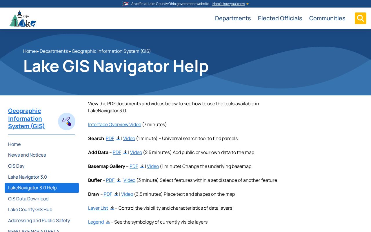
LakeNavigator separates Painesville parcel candidates from Esri World Geocoder suggestions. Its parcel popup can expose PIN, owner name, address, acreage, sale history, documents, and centroid information. Parcel, old-parcel, plat, neighborhood, sale, and document layers help place a Painesville address in context, but the GIS department states that its parcel ownership layer is not survey accurate.
Use the map to compare parcels along the Painesville street, then return to the Painesville-area Auditor record for tax-roll detail. A boundary question needs a survey rather than a map-screen inference.
Painesville Address Record Sources
Several Painesville address records can be matched, but they do not all prove the same fact. The Painesville-area Auditor identifies a parcel and tax-roll fields. LakeNavigator maps its physical and historic context. Lake County Recorder documents affecting Painesville track parties and legal descriptions. City and library materials add dated context when their own limits are stated. The table keeps the source, search key, and access route separate.
| Address record | Address/key mode | Coverage / proof value | Specific Painesville access |
|---|---|---|---|
| Auditor property roll | Street number/street, postal code, owner, PIN | Current tax parcels; ownership and mailing fields, not all residents | Basic property search; *street instruction |
| LakeNavigator | PIN, owner, address; map click and layers | Parcel geometry, popup, sale/document links, nearby parcels | LakeNavigator 3 and official tool guides |
| Recorder | Party, document, legal description | Recorded title and instrument history | AVA/Laredo; online index from 1986, images from 1990; Records Room |
| City permits and planning | Address, parcel, applicant, date in retained records | Work, approval, code, and meeting chronology | Community Development or city request; no public address portal located |
| Criss-cross directory | Address to listed printed name | Historical listing with edition limits | Morley Haines run, 1976 onward with documented gaps |
| Voter system | Name and county; precinct list under law | Individual registration or precinct context | Ohio My Voter/Board of Elections; no public initial street browse |
Note: A street name is a useful starting key, while the PIN and legal description are the safer bridge across the Auditor, GIS, Recorder, and older records.
Painesville Street Deed Trail
The Lake County Recorder route for a Painesville property is party-, document-, and legal-description keyed rather than a stated street-address index. Once the Auditor supplies a PIN and legal description, compare the purchase deed, document number, seller and buyer names, lot or tract, and plat reference. A recorded party can have more than one Painesville property. Match the legal description at every step before connecting a document to the Painesville street being researched.
This public Auditor parcel-record example shows the field layout used to preserve a parcel's address, ownership, legal, and tax context.
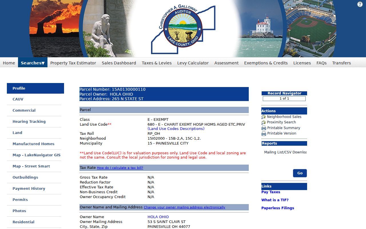
The displayed Painesville parcel-card structure is a bridge to Recorder research, not a deed image. Use recorded document references and the legal description to select the Lake County Recorder route for the Painesville parcel, then verify any relationship between a party and the specific parcel.
Painesville Street Deed Access
Lake County's first deed is dated April 16, 1840, but the Lake County Recorder's documented search options state that the online index begins in 1986 and online images in 1990. AVA offers basic information; Laredo Select is an advanced service requiring a registered password account. When a Painesville address trail reaches the web boundary, use the Records Room, the Recorder's public-record request email, a hard-copy request by mail, or an historical repository instead of treating the online gap as an absent record.
The Auditor Advanced Search screen is a criteria builder with Group, Criteria, selected fields, date/value condition, Add, Edit, Remove, Remove All, Save, Load, and Search controls.
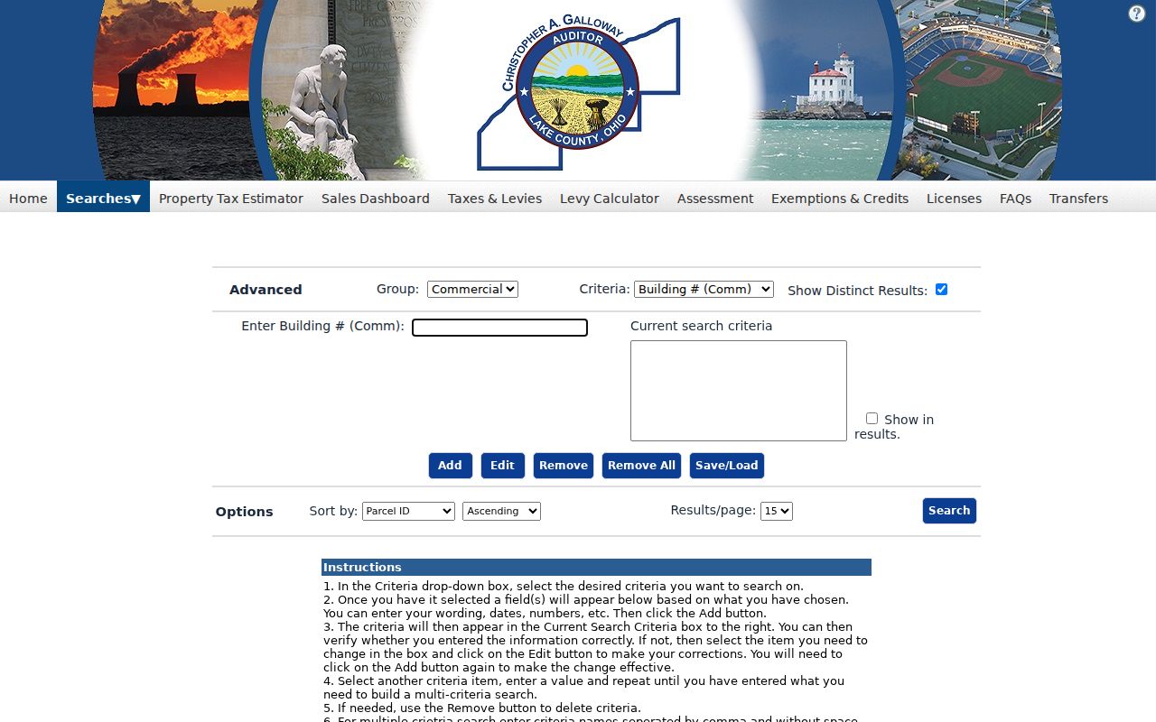
The inspected page did not publish a stable list of every criterion option before a group is selected. Use its visible controls as a refinement tool, not as an assumed universal street directory.
Painesville Street City Files
Painesville Community Development may hold zoning permits, building-related applications, code cases, planning materials, BZA packets, and 311-related work records tied to an address. The Painesville city government did not expose a public historical address-permit search screen. A focused Painesville public-record request identifies the address, year range, and record type, such as a permit log, application, inspection disposition, or code-enforcement correspondence. The city's public agendas, actions, minutes, and meeting video can also identify a planning or BZA matter by date.
Painesville city records are jurisdiction-sensitive. Read the parcel's Municipality field first because a Painesville postal address can be outside the city. A county or township office may keep a record for that Painesville-area parcel.
Painesville Street History Checks
Painesville's official map page publishes a Street Map updated in 2020, a Ward Map from 2023, and a Zoning Map from June 2025. Its code-library tables cover street-name changes, street and alley vacations, dedication and plat approval, street grades, annexation or detachment, and zoning-map changes. Those categories show where a present address may need a historic check. They do not establish a citywide renumbering date or a universal old-to-new address crosswalk.
For an older Painesville street form, preserve spelling, number, direction, suffix, city or postal place, PIN, municipality, and legal description exactly as sourced. Compare the 1904 Painesville Sanborn, Morley's indexed 1840 and 1857 atlases, a plat, and the Painesville ordinance table before deciding that an older and current Painesville address are the same place.
Painesville Street Listing Years
Morley Library's city-directory holdings identify 1923 as the first local Painesville directory with a street-address listing. Its Haines & Co. Lake-Geauga Criss-Cross holdings provide an address-to-printed-name route for 1976, 1977, 1981 through 1987, 1989, and a subscription from 1991 onward. A missing year matters. Compare the surrounding held editions rather than filling an interval with a guess.
The printed name is a dated directory entry, not proof that every person at the address was present. The longer collection history belongs with the Painesville city directory collections; use it when a street result needs a specific historic edition.
Painesville Street Postal Edges
ZIP 44077 is shared by Painesville City, Painesville Township, Grand River, Concord Township, and Leroy Township. A Painesville street search that returns a Painesville mailing city should therefore retain the Auditor Municipality field. Postal place, incorporated city, ward, school district, and Painesville parcel municipality are different labels. Use the appropriate custodian only after that jurisdiction check.
For postal verification, USPS ZIP Code Lookup confirms the delivery ZIP for a complete address. It does not determine the parcel's municipal boundary, recorded ownership, school district, or city service area.
Painesville Street Record Limits
Street and address records do not identify every non-owner or every person connected to a parcel. Ohio BMV data is restricted, utility customer lists are not an ordinary public street directory, and protected voter, Safe at Home, redacted worker, sealed court, and restricted vital-record material can limit a result. A Recorder or court party may be a trustee, business, attorney, lienholder, decedent, representative, or former owner rather than a current resident.
Lawful use. Painesville address records support personal research, property history, estate or heir work, civic transparency, and scam verification. Do not use them to stalk, harass, track, or harm any person, especially someone whose address is protected or redacted.
When the evidence does not answer the question, preserve the gap. A careful Painesville street directory search reports the record found, its date, and what it can actually establish.